

Employee ownership is accessible to everyone at RS&H. Learn how we collectively succeed together.

Resources  /   Events

Esri User Conference

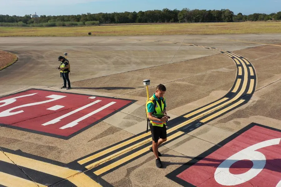
Two workers in safety vests surveying airport tarmac with equipment

Date

Jul 13-17, 2026

Location

San Diego, CA  

RS&H at Esri User Conference 2026

Join RS&H at the 2026 Esri User Conference in San Diego—where thousands of geospatial professionals come together to explore the future of GIS and location intelligence. As an Esri Gold Partner, we’re proud to share how we’re helping clients turn data into smarter decisions through real-world applications across aviation, transportation, and infrastructure. Connect with our team at sessions, networking events, and industry meetups throughout the week.

Esri state and local government specialty.

Join RS&H at the following sessions:

How Airports Strengthen GIS Maturity: Navigating the GIS Journey at Rick Husband Amarillo International Airport

Date: Thursday, July 17th
Time:
10-11 AM PDT
Speaker:
Rob Grotefend, GISP, National Discipline Leader, Geospatial

Rick Husband Amarillo International Airport (AMA) is advancing an enterprise GIS framework that strengthens asset management, maintenance, safety, and compliance. Through integrated Asset, Part 139, Lock and Key, and Pavement Management systems, GIS delivers operational intelligence. With ArcGIS Indoors expanding, drone integration maturing, future Obstacle Analysis, and SMS on the horizon, AMA is engineering a smarter, data-driven foundation for next-generation airport operations.

Drones and Reality Mapping SIG

Date: Thursday, July 17th
Time:
11:30-12:30 PM PDT
Speaker:
A.J. Thompson, Enterprise Drone Program Manager

Join a conversation with peers and Esri staff on the topic of drones and reality mapping in GIS. Learn from attendees about how they deliver insights to their end users and stakeholders, and share your experiences with others. Build connections, learn from peers, and bring actionable ideas back to your organization.

photo of Rob Grotefend, GISP

Rob Grotefend, GISP

National Discipline Leader, Geospatial
photo of A.J. Thompson

A.J. Thompson

Enterprise Drone Program Manager
photo of Alex Bonelli, GISP

Alex Bonelli, GISP

Geospatial Consultant
photo of Matt Adams

Matt Adams

AEC Platforms and Systems Manager
photo of KC Hinojosa

KC Hinojosa

Geospatial Associate

Related Resources

Insight
How GIS Can Be Beneficial to Small and Medium Airports
October 29, 2020By Rob Grotefend, GISP

By definition, a Geographic Information System is a framework for gathering, managing, and analyzing data. You may also hear GIS referred to as geospatial technologies when grouped with Computer Aided Design (CAD) and Building Information Management (BIM).

Aviation
Airplane on runway.

In this episode of AEC Perspectives, host Rachel Moore joins RS&H’s National Bridge Inspection and Preservation Leader, Corey Rogers, PE, and In-Service Bridge Inspector, Scott Brown, to explore how unmanned aerial systems are revolutionizing infrastructure maintenance.

Transportation

Drones are improving the way we document progress and perform inspections in the construction industry. As the drone community expands, opportunities to improve project oversight, inspections, and ultimately protecting transportation owners’ best interests are becoming more and more abundant

Transportation

Stay in the Know

Sign up to receive RS&H and industry news, blogs, case studies, and more in our monthly newsletter.

This field is for validation purposes and should be left unchanged.
Name
Accept GDPR Terms(Required)